 Inaugurated
some 25 years ago though Jenkinson
suggested it in his guide of 1874!.
 Inaugurated
some 25 years ago though Jenkinson
suggested it in his guide of 1874!.
Some 95 miles long - can be walked in 5 days though you might want
to allow a bit longer.
For most of the way you are in easy reach of accommodation (B&B
or hotels) and food/drink - however the section from near Jurby round
Point of Ayre and onto Ramsey is isolated and you will need to carry
sufficient supplies.
For most the easiest approach is to walk it in sections (sorry I'm not a purist!) and use public transport to reach start and stop-off points - all points indicated are served by buses though the service to Point of Ayre and Maughold is very restricted and that to Jurby is the least frequent of the rest. Douglas is the easiest for accommodation and transport, though reaching the northern sections will be time consuming - those with friends who can be persuaded to meet you at the more distant spots are the most fortunate. Otherwise a dual centre Douglas/Ramsey may ease the transport problems.
Personally I prefer to walk with the wind and sun behind me - as the wind (and rain) generally comes from the west this means clockwise travel on the west coast and, unless you are a purist, anti-clockwise up from Castletown on the east coast. Walking in sections may allow you to avoid some bad weather - as any local knows, the weather system in the north often bears no correlation to that in the south of the Island! I have left Douglas in mist and drizzle only to get over Maughold Head and find Ramsey bathed in bright sunlight. Long term weather statistics for Douglas give a mean 14-15 days on which it rains each month during April through to August. The north is generally drier but can be even windier than the south.
This page does not attempt to remove the need for a map, although in most sections the path is well marked and obvious, there are some sections where a map is essential. As any walker knows a map can also add much additional enjoyment in bringing many otherwise missed details to your attention. Guide books and maps were discussed earlier. Note the distances given are approximate - walking times over sand and pebble beaches can be more than you expect, especially if against the wind; the only section with extensive climbing is that from Port Erin to Peel. As the path passes, or is close to, many sites of cultural interest it might be advisable to allow extra time for sightseeing and photography.
All photos here are my own - taken over a few years worth of visits hence the different lighting.
As it is conventional to start any Manx parish list from Patrick and work clockwise round the Island, I will take each section in turn starting from Peel.
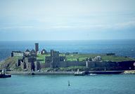 Peel,
the most Manx of the towns, is just opposite St Patrick's Island on
which is the historic Peel Castle, Old
St Germain's Cathedral, St
Patrick's church and round tower etc. It is also home to the
House of Mannannan - a newly opened Heritage Centre built
around the old Peel railway station.
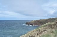 Apart
from a small section on leaving
Peel most of this path is along the trackbed of the old Manx
Northern Railway from St Johns to Ramsey (it never went to Peel for
which one either walked from Peel Road Station or connected at St
Johns for the Douglas- Peel service).
As the viaducts at Glen Mooar and Glen Wyllin are removed the path follows the sea shore at Glen Mooar before returning up Glen Wyllin, once the great resort for Sunday School outings, to Kirk Michael village and regaining the trackbed.
In many ways the best views are in the evening as the sun lights up the crumbling cliffs of Orrisdale head - the views backwards to Peel Castle are also impressive.
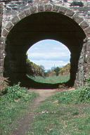 The
path follows the trackbed parallel to the main road with most of the
village (now rapidly expanding) on your right. It is worth a detour
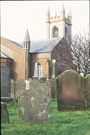
to look at the church
with some fine crosses
and newly restored grave of Bishop
Wilson (not before time after years of neglect).
 The Mitre (aptly named as Bishopscourt
is just up the road) would make a good stop prior to regaining the
trackbed - the strange castellated building in its forecourt is the
now unused courthouse and
gaol.
You leave the trackbed and turn towards the shoreline shortly before reaching Bishopscourt - again a short detour along the trackbed and along the footpath by the side of Bishopscourt is worthwhile, especially if the daffodils are in bloom.
Once you gain the shoreline you will be following it until you
reach Ramsey - the walking can be hard going on the sand and even
worse on the pebbles to the north. 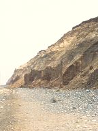 You
will be hemmed in by the crumbling Orrisdale head, land erosion is
quite extensive here. Be prepared to get your feet wet (especially if
it has been a wet season) as you cross the river at the Cronk. Here
too another short detour would bring you to Old
St Mary's, Ballaugh with its famous leaning pillars.
 About
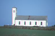
two miles past the Cronk there is Jurby
church on your right (it has a fine collection of crosses in the
porch) - about another mile there is the path via Sartfield which if
followed will take you to the corner of Jurby Airfield (now a small
industrial estate) - the pub, shop and bus stop are a short way down
the road to Sandygate (about a mile off the path). Except for these
amenities, the last until you reach Ramsey, it is not, I'm afraid,
worth a detour unless you wish to visit Jurby Junk (a hangar like
building full of bins of various second hand goods!) or Jurby Hotel
which still keeps some of its WW2 origins as the officers' mess.
Regain the path and continue walking! This part of the Island is mostly flat, quite different from the spectacular cliff views from Maughold southwards. To your right is the Curragh an area of drained marshland, at one time quite densely populated though now much emptier; many of the early emigrants to Ohio came from this area.
After some six miles you will reach the Ayres Visitors centre - the surrounding area is a conservation area for the fragile habitat.
 Another
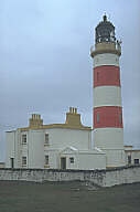
two miles brings you to the Point
of Ayre Lighthouse built in 1819 (strictly two as a smaller one
was built nearer the sea in 1891).
There is a bus service from here - but only some two a day so don't miss it otherwise you have a long walk into Bride for a slightly, but not much, better service. Whilst waiting see the impressive church and also visit the 'Green Parrot' cafe (now more prosaically named 'Bride Tea Rooms' but still with home-nade food) reopened late 1998 after a public outcry over its proposed demolition to ease the passage of the overweight lorries carrying gravel from Ayre that thunder through the village.
 Another
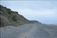
pebble beach section for much of the way - rather tiring walking -
probably the most boring section of the path until you pass Dog Mills
and can see Ramsey in
front of you.
A small section of road before reaching Port-e-vullen where the path along the brooghs to Maughold Head starts (if the tide is out you can avoid some of the road by walking along the beach from Queens pier to Ballure and onto Port Lewaigue - however the road is recommended unless you have checked the tide-table).
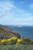 The
few miles to Maughold Head is one of my favourite short sections with
fine cliff views and a great view of Ramsey Bay.
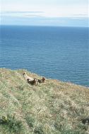 Unless you choose a popular weekend in the season your most likely
companions are the sheep!
Maughold lighthouse is built halfway down the cliff face at the head.
Follow the path through the large graveyard which is on the site of a Celtic monastery and look at Maughold church - the large slab memorial, designed by Archibald Knox, is that for Hall Caine. Three, somewhat restored, keeils are in the yard. Don't forget the cross-shelter in the yard - designed by Armitage Rigby to shelter some of the many Island Celto-norse crosses.
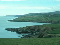 Although there is a bus service to Maughold (relatively infrequent)
if you are leaving the path here then the best choice is to continue
along the path for a mile (most of which is around the headland to
Port Mooar) before it crosses the MER at Ballajora and catch
the 'tram' to Laxey and Douglas.
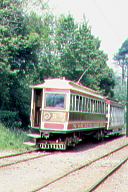 You will be seeing quite a bit
of the MER in the section to Laxey but for the moment the tram has the better coastal views as the path heads inland before
turning down Ballaglass Glen down to Port Cornaa. There was once a proposal at the
end of the 18th century to turn this small bay into a harbour, however nothing came of it. Having reached the sea, you
immediately head back inland up Glen Mona at the head of which you turn south and strike for the MER. From here on, until
Laxey, the path keeps parallel with the MER and the Laxey-Ramsey road; the MER getting the better coastal views (quite spectacular
at times - if you do catch the tram be sure to sit on the seaward side).
The path drops down into Laxey, crossing the old bridge before following the shoreline until dog legging back up to the old road at Fairy Cottage and following it until Baldrine (not a pleasant section with the traffic on this busy road).
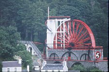 Laxey
developed greatly in the second half of the 19th century due to lead
and silver mining. You will have passed some of the store buildings
at Laxey Harbour. The new road and MER loop around the top of the
valley in a tight U-bend. In the bottom of the U was the washing
floors for the lead ore - a great spoil mound was here but has now
been removed and the washing floors left as a garden. The actual
mines are further up the valley - the famous Lady
Isabella (or Laxey Wheel) was built in 1854 to drive the pumps
draining the mine. It is the largest waterwheel in existence and well
worth the 2 mile detour.
 The
path drops back into Garwick Bay avoiding Baldrine, before dog
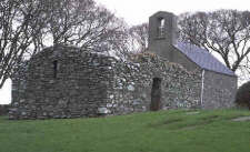
legging inland around Clay Head. Some 2 miles from Baldrine the path
passes Old St Lonan's
Church; very worth a visit.
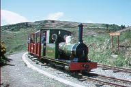 After
St Lonan's the path drops down into Groudle Glen crossing the narrow gauge
Groudle Glen railway built in 1897 to take trippers to the polar bear and sea lions in cages at the cove. The railway has
been restored though the cages and cove, with its viewing bridge have not.
You are now in Onchan - the path and the MER follow the edge of the golf course; Howstrake Camp, one of the several such established around the early years of this century to provide cheap holidays is to your left. The path continues along the cliff edge before joining the road at Port Jack a short step from Derby Castle - the terminus of the MER and the Douglas Bay horse trams. Assuming you walk the path follows the promenade round Douglas Bay to the 'Lemon Squeezer' ferry terminal. About midway around the bay is Castle Mona - now somewhat hemmed in but originally impressive in its isolated site by the shoreline. The promenade on which you are walking was reclaimed seashore - the most impressive section being south of Castle Mona built in the 1870's under the instigation of Governor Loch which really placed Douglas on the tourist map for the working class from the North of England.
Cross the harbour by the new bridge (the old swing bridge was demolished late 1998) and climb towards Douglas Head, at the turn of the century the play ground for many of the holidaymakers who flocked to the Island in their tens of thousands.
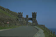 Once
over the head go through the ornate gates as the path follows Marine Drive unto Port
Soderick - until the start of WW2 there was a standard gauge tramway along
this section with viaducts across some of the sections which must have provided an exhilarating ride. Landslips forced the
closure of the road so there will be little traffic though the Douglas section is a popular lunch time escape from the office.
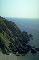 The
end of Marine Drive is Port Soderick where the tramway finished and a cliff railway
took visitors back to to join the IoM Railway Douglas-Port Erin line.
The path climbs up the other side of Port Soderick Glen to cross the railway at Port Soderick station, now impressively restored as a private house though fortunately this section of the railway is still in operation.
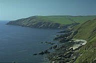 For
the next mile the path follows the old Castletown to Douglas road
before turning sharp left to reach Santon head and follow the
coastline round to Port Grenaugh.
The path continues along the coast, though with a detour to cross the Santan river (you could follow T.E.Brown's advice and swim across but not recommended - however if it is wet you will wish you did, as the path after scraping you through gorse bushes takes you through a quagmire!). P.G.Ralfe (a noted ornithologist) gives a good description of this part of the coast as walked nearly a century ago - some things have changed though - William Christian's house was demolished to make way for the airport.
Langness and Derby Haven are in front of you. The path skirts the back of Ronaldsway airport and crosses the site of the battle of 1275 which marked the end of an independent Manx kingdom and the start of a 100 years of Scots domination before the English 'acquired' the Island.
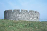 The path crosses the narrow neck
of land joining Langness to the mainland - the keen walker will however not begrudge the extra three miles or so to visit
both St Michael's Island with its early
church and well preserved 1640's Derby Fort and, at the other end of Langness, the lighthouse
at Dreswick Point and the fine views over most of the eastern side of the whole Island.
The Castletown Bay side of Langness is a favourite haunt of waders and other birds - bring your binoculars and bird-spotting guidebook!
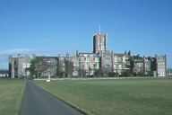 The
path continues along the shore of Castletown Bay, the impressive
building to your right is King
William's College, a minor public school founded in 1833.
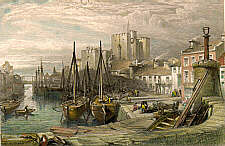 Continue
along College Green into Castletown
and cross the harbour by the small pedestrian bridge by the side of
Bridge House of which
part is the nautical museum - another recommended break. Compare the
mid 19th century view and little has appeared to change.
Castletown still shows its medieval street structure though most of
its impressive buildings date from the early 19th century.
Allow yourself time to visit the Castle at least - a visitors
information centre is tucked away in the old
grammar school which is on your path as you turn away from the
town to follow the bay.
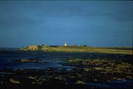 Castletown
is built upon limestone - you can see the local stone in many of the
buildings but especially in Castle
Rushen which dominates the town. The rest of the island is
deficient in lime and for many years there was a major lime burning
business along the coast from Castletown to Scarlet Point (the kilns
are visible in the photo) . Just before the Point is the Scarlett
visitor centre which offers an excellent guide and suggested
viewpoints on the path.
Scarlett head is rich both in prehistoric sites and keeills though some of the buildings seen are left over from a WW2 radar station built on the head.
At Poyllvaaish (Pool of death) can be found the black 'marble' once popular for fireplaces; a small marble company still operates here. The path follows the shoreline of Bay ny Carrickey round into Port St. Mary - however the two mile section from Strandhall is shared by the road though the views are some recompense.
Some of the most spectacular cliff scenery is along this section which take you around Mull hill - this area is also rich in antiquities - again P.G.Ralfe's description is still worth reading.
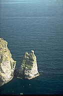 The path, once out of the villages, is good with a fair amount of up and down
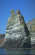 Two of the more spectacular sights are the
Sugarloaf and the Chasms. The cliffs are the breeding ground for thousands
of sea birds - again binoculars recommended, especially in the breeding season.
These are around bay Stacka (the stacks) - the path rounds Black
Head and onto Spanish Head. The oft repeated tale that this is
so-named because a spanish galleon from the Armada was wrecked here
has, I'm afraid, no basis in fact.
The Calf, and its own calf Burro joined by the Eye, will
have been visible once you round the head. 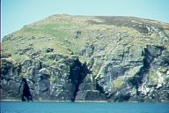 The
stretch of water between you and the
Calf is the treacherous Sound with some vicious currents to trap
any mariner, though once in the early days of paddle steamers two
followed each other in a race through these waters.
The small island in the Sound is Kitterland. The path now turns
north east and heads through Aldrick and Bay Fine to Port Erin; there
are fine seawards views in this section.
Port Erin, was developed as a holiday resort at the end of the 19th century - there had been an attempt in mid century to build a breakwater and develop it as a port (which is why the railway choose to have its terminus here). Storms destroyed the partly built breakwater - the dislodged blocks can still be seen near the headland - the storm over the financing of it had a similar dislodging effect as it helped force the House of Keys to submit to the voter rather than continue as a self-elected body.
As it is a short section, a detour to take in the open air museum at Cregneish is highly recommended - this was one of the first such museums in the British Isles and has been restored as a typical Manx village of the late 19th century - the Manx language held out here till quite late.
This section of the walk is probably the hardest but given good weather very impressive. There is no source of refreshment along the path until you Niarbyl. It starts and finishes (almost) at two towers! Milner's Tower is on Bradda Head just out of Port Erin whilst Corrin's tower is a folly overlooking Peel.
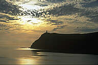 At
midsummer the sun sets behind Bradda Head as viewed from Port Erin.
Milner's Tower is visible on the head.
Follow the path out of Port Erin and climb towards Milner's Tower, the path continues around Bradda head with some impressive sea views before reaching Fleshwick Bay in some 2 miles.
In the description of the part of the coast between Fleshwick and Dalby given almost a century ago by Pilcher George Ralfe he states
"To the lover of scenery and wild life, there is no Manx district more fascinating than the coast between Fleshwick and Dalby. ... Guide books have little to say about this region, and to most even of Manxmen it is an unknown land. ... Along the whole extent of this coast-line there is no inhabited house, nor does cultivated land approach the shore. Human occupation has hardly left its mark. ... but to follow on foot the coast is extremely toilsome owing to the roughness of the ground, and the deep gullies to be crossed or rounded, while the strands and caves are scarcely attainable by land. Only here and there can sea level be reached."
 The
path, as you may be glad to learn after this, does not follow the
shoreline but after Fleshwick climbs to over 900feet before passing
the hut circles opposite the Sloc which point gives a fine
view down the valley of the Colby river. More climbing is ahead as
the path ascends Cronk ny Arry Laa (hill of the rise of day,
1434 ft). The isolated keeill in Lag
na Keeilly (valley of the church) is best approached by the
footpath to your left, some half mile after the summit as the path
drops down Gion Mooar. The path climbs back to 500ft before
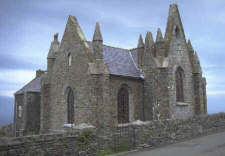
descending to Dalby with its intriguingly designed church
by John Welch (1839) - the building served as both church and
school.
|
|
A brief section of road takes you almost to Glen Maye before which the path drops towards the coast, follows a hair-pin up and down Glen Maye (where it is joined by the Bayr ny Skeddan taking the cross country route from Castletown). |
|
|
It then follows the coast, passing below Corrin's tower for which a detour is mandatory! |
||
|
The path then cuts across Thistle Head for the descent into Peel and the end of the circular tour. |
|
|
|
|
||
|
|
||