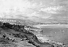
Douglas, from the Hill near Fort Anne
Dates from a year or so before Taggart's Map of 1834. Several points
to note - the most obvious is the emptiness of the scene! Douglas town is concentrated in the triangle around the
upper harbour, mostly out of sight mid foreground. The spire in the centre is the recently constructed St
Barnabas. Above this are the three fine houses forming Finch Road with, the also newly constructed, Scotch
Kirk; Prospect Hill can be seen winding up the hill. To the left is the newly constructed Athol Street leading
up to St George's.
On the far right of the bay is Castle
Mona; to its left is Villa
Marina; the larger building to the left is Marina
Terrace. To the left is Strand Street (then Sand St) - the
Loch Promenade was still 50 years in the future.
Centre foreground is the Red
Pier.
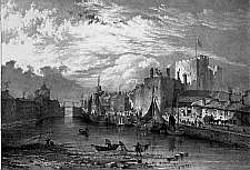
Castle Rushen
A morning view showing a busy inner harbour scene in Castletown Castle Rushen dominates; however notice how built up is the other side of the harbour. Bridge house is the tall building on the left.
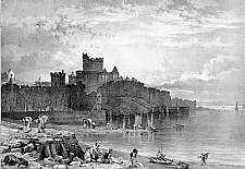
Peel Castle
Classic view of St Patrick's Isle taken from green overlooking beachLaxey
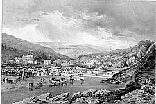
Fair day in Laxey.


