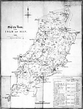
 Miller, 1829
 Miller, 1829
A Map of the Roads in the Isle of Man 1829
from Stone by A Miller & Co L'pool
560mm x 380mm
Taken from Smythe 1826 but with additional information re heights, distances etc added. The table of sheading names etc bottom right, mostly derived from that on Smythe includes boxes to indicate colours - however my copy is uncoloured- it is also folded as though intended for a small pocket map.
I can find nothing about A Miller though there is an entry under Printers in Slater's 1852 directory of Liverpool businesses of Turner & Rose at 7 South Castle St.
|
|
||
|
Any comments, errors or omissions
gratefully received The
Editor |
||