The background for these views by Daniel King is given in my introduction.
The first five show Castle Rushen in relationship to Castletown which grew up alongside to service it.
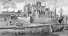
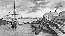
A The way into ye Castle B The gate of the Castle. C The round towers of the counterscarpe D The wall of the Castle. E The new buildings nth in the Castle. F The towne nth in the Castle. G The New Worke. H The way to the Burne, I The Burne, K The Sand. L The houses of the towne. M Barroole. |
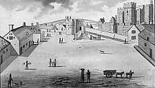
A The Street. B The market crosse. C The counter scarpe of stone & Tower. D The walls of ye Castle. F The Castle. F The Gournors House. G The rest of the houses i'th Towne. |
|
This view is looking up what is now the Parade viewed from St Mary's Church. Castle street is seen joining from the right. The Governor's house became the George Hotel. |
A The innerward of the Castle. B The wall of the Castle. C The wall aboute the Castle. D The Counter-Scarpe. E The new building wherein ye Earle of Derbie lived. F The new Worke. G The Burne that the Sea comes in. H as the Towne appeares. |
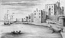
A The Sea. B The Shore. C The new worke. D The waie to the Castle. E The Castle. F The Wall. G The Counter Scarpe. |
|
This view is taken from very near to the present day road bridge over the Silverburn into Castletown. The 'new work' is a gun position covering the harbour - the site is approximately that of today's Castle Arms pub (or colloquially the 'Glue Pot') and also provided the base for the later footbridge across the narrowed river. |
This view show the narrow exit from Castletown harbour; the low-lying land mass beyond the harbour mouth is Langness |
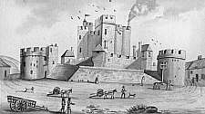
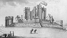
The following two views concentrate on the Castle
A The Counter-Scarpe. B The Round towre on ye Counter-Scarpe. C The Wall of ye Castle. D The houses of ye town. E The Wall about the Castle. |
|
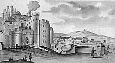
This view is taken from today's Parade, approximately from the George. The strange object on the right is probably the town gibbet. Both round towers have been demolished - the site of that on the left was used for the 19th century Market Hall (later Custom House and now Bank) |
A The Castle. B A Wall about the Castle. C The Counter-Scarpe of Stone being 12 yds broad 7 yds deepe. D The new building where in my Lord lived. |
|
This shows the side of the castle as viewed from Parliament Square - note however that King has used his artistic licence to ignore the houses along Castle street and exagerated the distance from the Castle |
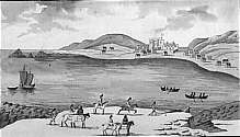
A The Sand. B The Sea. C Castletowne. D Ballasalley. E
Barroole. F Scarlett. G The Shelves of the Rocks. |
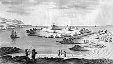
A The Rocks. B The Sands. C The Water. D St Michaells Island. E St Michaells Chappell. F Derbies fforte. G The false Sobria. H The Rockes at Ranenes. |
|
The 'false Sobria' is I think a reference to the conjecture that the Diocese of Sodor and Man was so named from a place called Sodor, sometimes placed either at St Patrick's Isle or St Michael's Island. |
|
||
|
||
Any comments, errors or omissions
gratefully received The
Editor |