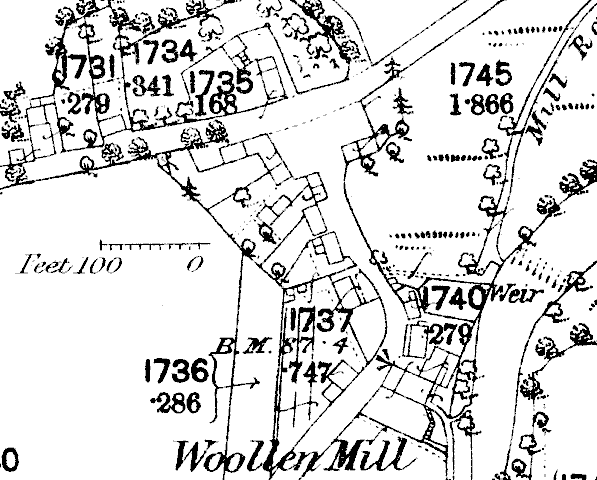

The Sulby river running downstream from the slopes of Snaefell can be seen exiting towards Ramsey to the East - the land on the eastern bank of the river a little off the map to the east is Sulby Claddagh - the main road from Kirk Michael to Ramsey is about 500m north of the old village. The new village developed along this road near the Kella mills.
There were many water-driven mills along the Sulby - that shown on the plan(near 279 on plan) is Southward's woollen mill which specialised in blankets - the tenting ground can be seen on the left of the road.
The view of the old village is looking south-west from the junction with the road heading north towards the main road and Sulby Glen Hotel.
|
|
||
|
|
||
| Any comments, errors
or omissions gratefully received The
Editor © F.Coakley , 2011 |
||